The “Nano Banana” Hack: Time Travel with GPS
Stop typing “Old India.” Start using the secret language of coordinates.
Have you ever tried to generate a historical image with AI, but it looked… fake?
You type “India in 1947” and get a generic picture that lacks soul. Stop doing that. It’s time to use the “Nano Banana” method.
What is it? “Nano” stands for precision (GPS). “Banana” stands for peeling back the layers of time.
Instead of words, we use Latitude and Longitude. This triggers the AI’s “geospatial memory,” giving you hyper-realistic, accurate images that go viral instantly.
PART 1: The Indian Heritage Collection
Perfect for nostalgic Reels and “Then vs Now” posts.
📍 The Red Fort (Independence Day)
"Create a cinematic historical press photo at coordinates 28.656° N, 77.241° E in the year 1947. Show the massive crowd gathered for the first Independence Day. Sepia tone, grainy film texture, emotional atmosphere."
📍 Gateway of India (British Era)
"Create a hyper-realistic image at coordinates 18.922° N, 72.835° E in 1935. Show vintage 1930s cars, British officers in uniform, and the calm sea in the background. Black and white photography style."
📍 The Howrah Bridge (Wartime)
"Create a moody atmospheric image at coordinates 22.585° N, 88.347° E in 1944. Show the newly constructed bridge with military trucks crossing it. No city lights (blackout conditions). Foggy night."
📍 The Golden Temple (Ancient)
"Create a serene image at coordinates 31.620° N, 74.876° E in 1890. Show pilgrims in traditional 19th-century attire. The temple reflects in the water. No modern buildings visible. Golden hour lighting."
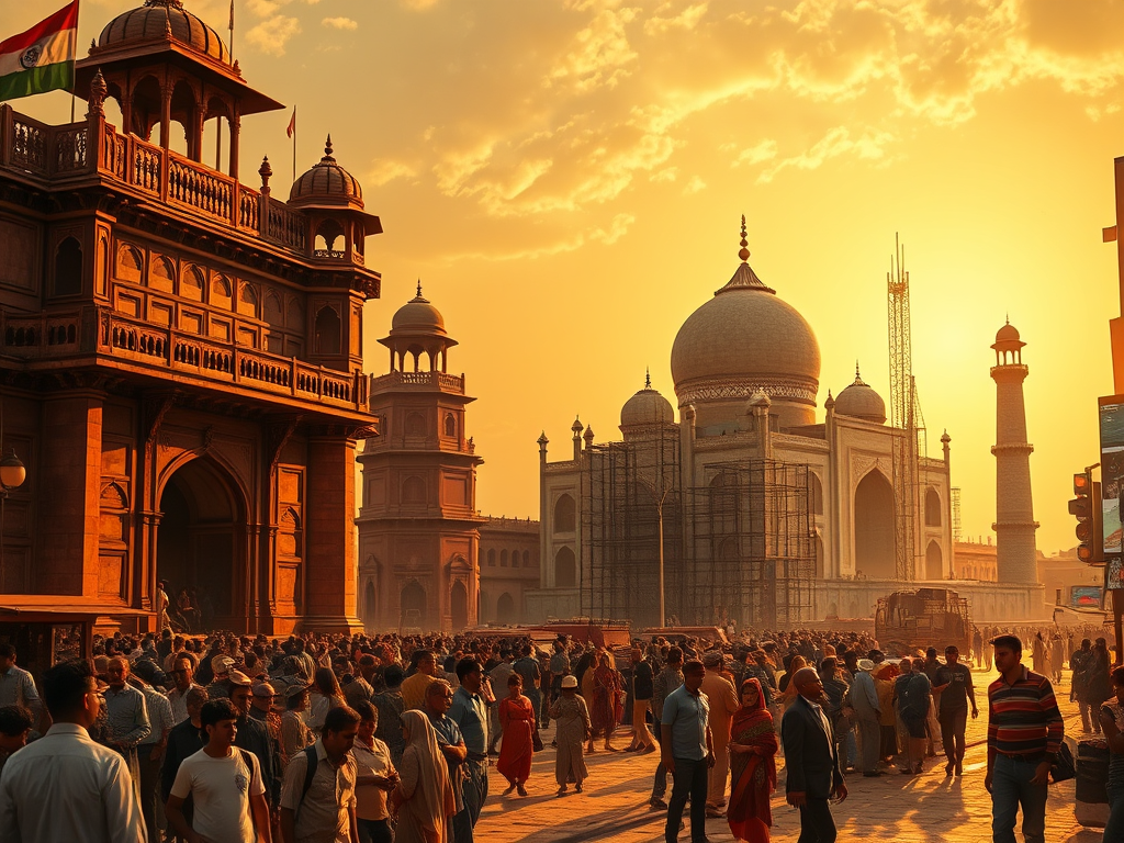
📍 The Taj Mahal (Under Construction)
"Photorealistic image at coordinates 27.175° N, 78.042° E in the year 1640. Show the Taj Mahal surrounded by wooden scaffolding and elephants carrying white marble stones. Dusty atmosphere, historical construction site."
PART 2: World History Collection
Capture the global audience with these time-travel shots.
📍 The Eiffel Tower (World’s Fair)
"Create a vibrant colorized image at 48.858° N, 2.294° E in 1889. Show the Exposition Universelle. Focus on the reddish-brown color of the original tower paint. Hot air balloons in the sky."
📍 Statue of Liberty (Original Copper)
"Create a detailed image at 40.689° N, 74.044° W in 1887. Show the Statue of Liberty in its original shiny copper (bronze) color before it oxidized to green. Ships in the harbor."
📍 The Pyramids (Discovery Era)
"Create a cinematic image at 29.979° N, 31.134° E in 1923. Show British archaeologists, camels, and the Great Sphinx partially buried in sand. Sunset lighting."
PART 3: Future Shock (2050+)
Use the same coordinates to predict the future.
📍 Times Square (Cyberpunk 2080)
"Photorealistic image at coordinates 40.758° N, 73.985° W in the year 2080. Show New York City as a cyberpunk metropolis. Flying cars, massive holographic ads, neon rain. 8k resolution."
PART 4: The Master Formulas
Copy these templates to create your own viral images.
Formula A: The Time Traveler
"Create a wide-angle drone view image at [Insert Coordinates] in the year [Insert Year] showing [Insert Activity]. Historical camera style."
Formula B: The Moody Weather
"Create a moody cinematic image at [Insert Coordinates] in [Insert Year] during a heavy [Rain/Snow/Sand Storm]. High contrast."
Try It Now.
Go to Google Maps, right-click any location to get the coordinates, and plug them into the formula. Tag us when you go viral!